Chris was kind enough to bring (and leave) the Kauai trail book he got last time he was on the island. We also have the The Ultimate Kauai Guidebook, 5th Ed. (which we borrowed from Marc and Tina) and a State Park Recreation Map of Kauai. The three of them have been great resources for finding trails to hike. I have been out on a few hikes now and I thought I would share my experiences. So far I have hiked the PowerlineTrail, the trail to Secret Falls, the Okolehao Trail, part of the Kalalau Trail, the Hanakapiai Falls Trail, the Kuamoo-Nounou Trail and the Kuilau Ridge Trail. There is for sure one new hike I plan to do, the Kalalau Trail to Hanakoa Falls, and perhaps one or two other new trails. If/when I hike them, I will add new blog entries.
Of the hikes listed above I would say the one I liked the best is the Okolehao Trail. I think it has offered the biggest bang for the buck. It is a pretty short hike but you get some great views of Hanalei Bay as well as most of the north side of the island. Follow the link for some details and photos from all the hikes.
Powerline Trail
I hiked part of the north side of this trail before Chris and Brooke arrived. After their arrival the three of us hiked the entire trail. We started at the south end of the trail hiked about 10 miles to the north end. Danika dropped us off and picked us up. There have been some other blog entries about this hike, so I am not going to add anything else.
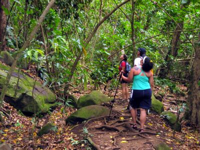
Trail to Secret Falls
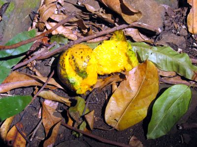
This hike was part of our kayaking day. We rented kayaks and paddled up the north fork of the Wailua River to the trail head. We then shored our kayaks and hiked about 1 mile on a trail covered with rotting mangoes. It was a fairly easy hike (I was most worried about slipping and falling in the rotting mangoes or being pelted with one falling from a tree) on a mostly level highly traveled trail. The falls (or should I say mist) at the end of the hike were a bit of a let down, but at least we hadn't hiked a long way to get to them.
Danika, Brooke and Chris checking out the mangoes.
The mango that nearly slaughtered Danika.
A rock formation before the falls (I think it was cooler than the falls).
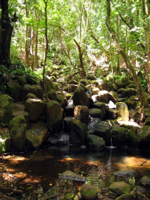
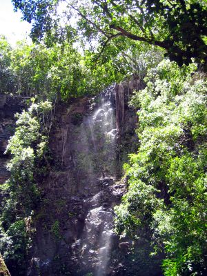
Secret falls (the day we were there it was more of a secret mist).
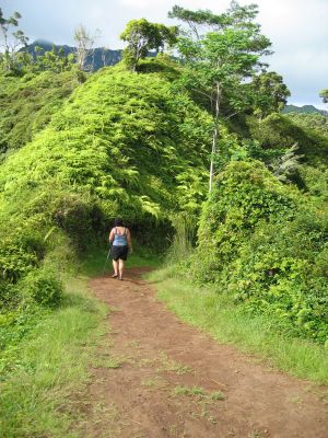
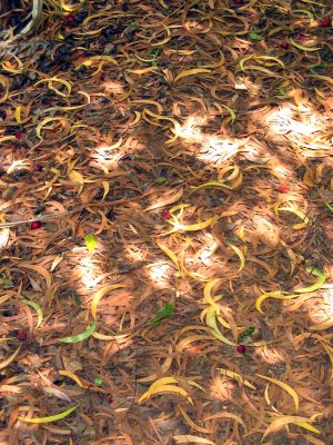
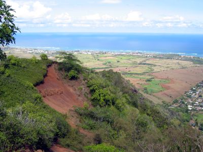
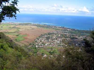
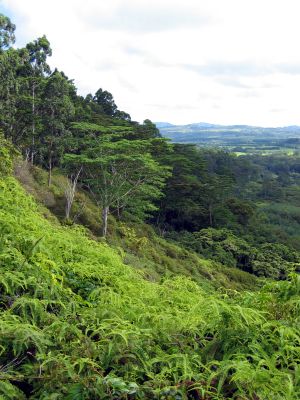
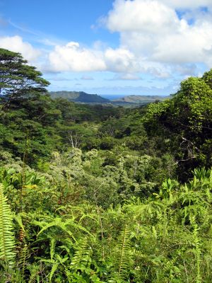
Okolehao Trail
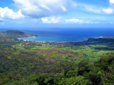
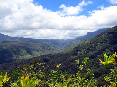
As I said above, this has been my favorite trail so far. It starts off just past a Chinese cemetery. The first part of the trail is an old road that is pretty steep and is pretty boring. The total trail is just less than 2 miles and gains about 1250 ft in elevation. Once you reach the end of the trail the view is absolutely amazing. The travel book says you can see a fifth of the entire island when weather permits and I can't say if that is true or not, but what I can say is that you can see a heck of a lot of the island.
One of the graves in the Chinese cemetery.

Hanalei Bay.
The valley on the east side of the trail.
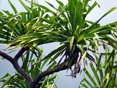
I thought I had found a pineapple tree :) It is actually a Pandanus Tectorius (hala) tree.
These leaves reminded me of the pattern on one of Danika's shirts... plus I thought they looked cool.
One of the nice things about this trail was much was covered so I wasn't out in the hot Kauai sun.
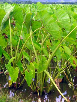
This taro wasn't on the trail instead it was on the road where I waited for Chris and Brooke to pick me up.
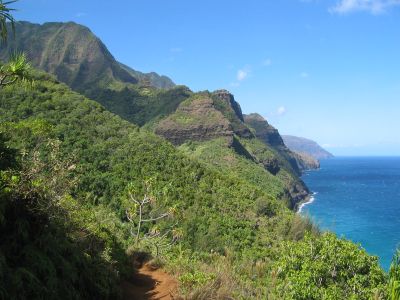
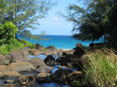
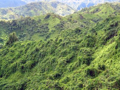
Kalalau Trail
This is Kauai's famous Na Pali Coast trail. In total it is 11 miles long (22 miles round trip) and the books list it at about 5000 ft of elevation gain (up and down, not just up). Chris, Brooke and I hiked the first two miles of the trail, then the side trip to Hanakapiai Falls (see below) and then back out (about 8 miles total and about 1800 ft of elevation). The views from this trail are absolutely stunning. The Na Pali Coastline is truly a thing of beauty.
Kee Beach from the trail.
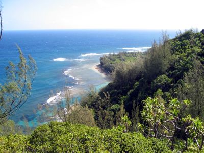
Part of the Na Pali Coastline (photos don't really do it justice).
The Hanakapiai Stream where it empties into the ocean at Hanakapiai Beach.
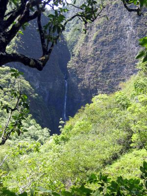
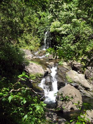
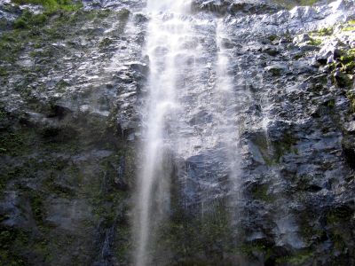
Hanakapiai Falls Trail
As mentioned above this is trail you can hike as a side trip off the Kalalau Trail. There are a few mango and guava trees, so I ate a few guavas along the way and Brooke ate a mango. There was also a spot with clumps of gaint bamboo. The main reason to do this hike is to get to Hanakapiai Falls where you can swim in the pool and under the falls, just watch out for falling rocks.
Our first view of Hanakapiai Falls.
Some smaller falls in Hanakapiai Stream.
A closer shot of Hanakapiai Falls.
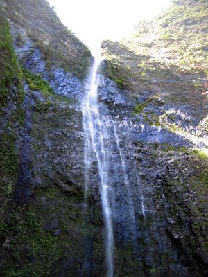
Another shot of the falls.
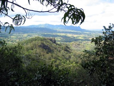
Kuamoo-Nounou Trail
This trail goes up Nounou Mountain (sleeping giant) and gives you a view of Kapaa and Wailua. It is a shorter hike, the book says 6 miles, but I think it was shorter. Of all the trails I have hiked so far, this was probably the least spectacular.
A wooden bridge at the start of the trail.
A view of Kapaa.
A view of Wailua.
Kalalea mountain (in the background).
A large cluster-f*ck of trees along the trail.
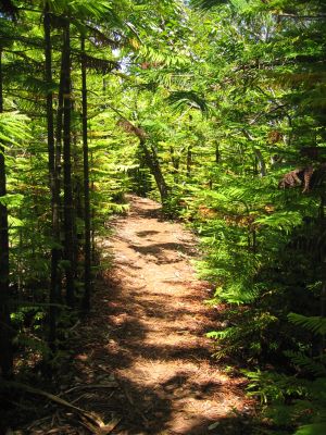
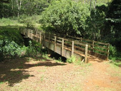
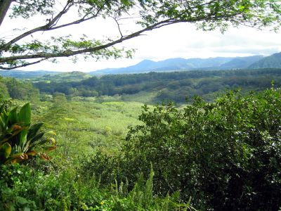
Kuilau Ridge Trail
This was a nice hike (that Danika did with me). You can see the power lines (that I hiked underneath on the Powerline Trail) along most of the trail and you get a lot of very green views of the surrounding valleys. The trail markers say the trail is 1.75 miles, but the books say it is 2.25 miles. In either case, Danika and I did 1.75 miles to a wooden bridge, then turned around and hiked back out.
If you look closely you may be able to see the power lines.
Green...
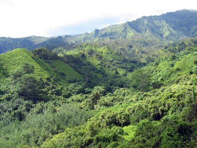
...green...
...green...
...and more green.
There's Danika.